Automated Safety
Farm Safety
Farm Management
The Importance of a Farm Map
By James Diamond, August 16, 2022
Knowing where you stand in the present and plotting out the steps necessary to get to the future you envision for yourself is the foundation of effective planning. This involves figuring out what resources you have available to you in order to get you to the place you envision yourself being.

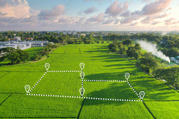
This calls for meticulous preparation, and one of the very first things a farmer ought to do is construct a helpful farm map.
1.) areas on the farm that are susceptible to the contamination of water (sensitive areas such as streams, wetlands, waterways, or any other place where water coming from the livestock operation or barnyard comes into contact with clean water), and
2.) practices that may contribute to the pollution of water that is located on the farm (such as not having proper manure storage or spreading manure too close to a stream or wetland). This foundation map of the farm has to represent all of the agricultural fields, the area encompassing the farmhouse and barnyard, related usage zones, and regions such as wetlands and forested land.
The knowledge of a property, including its various paddocks and its boundaries, is acquired over the course of time and, in some cases, generations. This can lead to misunderstandings, such as the wrong mob of sheep being drenched, cattle being moved to the wrong paddock, fencing contractors operating in the wrong spot, rippers through water pipelines, or staff members being lost.
It will be good for you to design a farm map that contains barnyard sketches for buildings, storage, fences, fields, streams, rivers, wetlands, etc. If you do this, you will have a better idea of how to lay out your farm. Include areas such as fields that animals use for exercise or grazing, as well as any areas where manure is distributed. The property lines of a piece of land can be determined with the help of a boundary survey, which is sometimes referred to as a “beginning point” in legal documents. This will reveal the extent of any easements or encroachments on the land, and it may also illustrate the constraints that are placed on the property as a result of state or local legislation.
The collection of all this information may appear to be a laborious task. However, there are tools available to assist in making the process more effective.
Investing some time in mapping your property is time well spent for the purposes of planning, conducting management analysis, and making decisions. You may map your infrastructure in a way that is obvious and dynamic, determine the areas of watered pasture, assess the changes in your ground cover, and then plan modifications you want to make thanks to the value of an online map.
In addition, an accurate map can ensure that new employees or contractors are able to maneuver around your property in a risk-free manner.
Additionally, please ensure that they are directed to the appropriate paddock in order to replace the pump and that they do not dig through the pipeline.
When making management decisions like grazing programs and crop rotations, a farm map can be helpful in identifying the different types of soil as well as other characteristics like slopes that are present on the land. A map might be of great assistance when identifying places for the storage of compost or manure. The preparation of an emergency plan can benefit greatly from the use of a farm map. In the event of an unexpected spill of manure, a map can assist in locating sensitive bodies of water or wells that may be impacted. In the event of a fire, a map can be used to determine the locations of stockpiles of grain and hay as well as the fuel and chemicals that are kept there.
Another advantage of having a farm map is that it can be used by farmers for future planning or adjustments they plan to make, as well as by others who can assist them in making the most of their property given its planned purpose.
Runoff water that is contaminated with manure that comes from the livestock operation, barnyard, or manure storage will be identified on a map of the farm in the places that come into contact with pure water. The map may also disclose whether or not manure is distributed in an area that is dangerously close to a stream or wetland. A map can also assist in identifying different types of soil and the characteristics of those soils, which can be helpful when making management decisions regarding crop rotations and grassland management. It is also helpful to have a map of the farm when preparing for the future of the farm.
The foundation map of the farm has to represent all of the agricultural fields, the area encompassing the farmhouse and barnyard, related usage zones, and regions such as wetlands and forested land.
Using the AirAgri farm map gives you the ability to return to this information at any time—you can change the position of your paddocks, fence lines, and troughs; easily reevaluate the sizes of your paddocks and the areas that are watered, and have instant access to paddock and infrastructure reports.
